DLTK's Crafts for Kids
Canada Crafts, Facts, and Activities for Kids
Disclaimer: Please keep in mind this website is meant for children, so I do generalize and simplify quite a bit!
For a resource for North Americans (and others) to find out where they reside, please see this interactive map of Indigenous territories, treaties, and languages. A disclaimer from the project: "This map does not represent or intend to represent official or legal boundaries of any Indigenous nations. To learn about definitive boundaries, contact the nations in question."
Well, if you didn't know before, you probably just figured it out: D, L, T, and K are Canadians! Canada, a country in North America, has some of the most beautiful geographical landmarks on earth! It is an interesting country for children to study for this reason.
Moraine Lake, Banff National Park, Alberta, Canada
Photographed by Giuseppe Milo; used with permission under C.C. BY 2.0
Canada is currently the second-largest country in the world by total area (spanning 9.98 million square kilometers). Russia is the largest country in the world. Canada’s official languages are French and English, with other languages such as Mandarin, Cantonese, and Punjabi being the next most-spoken in the country.
Since Europeans settled the land known as "Canada" through violent colonization, the languages of English and French (both historically colonial countries) have been entrenched as the legal ones, but there are many Indigenous languages spoken by Indigenous nations across Turtle Island such as Ojibway, Inuktitut, Oji-Cree, and Mi’kmaq.
Canada is a country found in the Northern Hemisphere and the Western Hemisphere of the globe. As of 2021, the country is split into 13 political divisions (10 provinces and 3 territories) from west to east: British Columbia (BC), Alberta, Saskatchewan, Manitoba, Ontario, Quebec, Newfoundland and Labrador, New Brunswick, Nova Scotia, Prince Edward Island (PEI), Yukon, Northwest Territories, and Nunavut.
Bordering Canada on both north and south sides (if we take Alaska into account) is the United States of America. Canada is located between the Pacific Ocean on the west coast (in BC), the Atlantic Ocean on the east coast (the Maritime Provinces), and the Arctic Ocean to the north.
Capital city: Ottawa, Ontario (ON)
Language: English, French
National Bird: Gray Jay (Perisoreus canadensis)
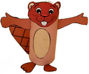
National Animal: Beaver (Castor)
National Flower: Bunchberry (Cornus Canadensis)
Currency: Canadian dollar (CAD)
Canada is often divided into 7 geographic regions, all of which are extensively taught in Canadian schools:
Arctic Lands
60% of the world’s polar bears live in Canada’s Arctic region.
Short, cool summers and long, cold winters maintain what is known as a “permafrost” in this region.
75% of the world’s narwhals live in Canada’s Arctic region.
Very little vegetation grows in the Arctic region.
The Arctic Region contains the Yukon, Northwest Territories, Nunavut, parts of Northern Quebec, and the most northern parts of Newfoundland and Labrador.
Cordillera
The landscape of the Cordillera has long chains of high rugged mountains (known as the Rocky Mountains); Canadian Rocky Mountain Park is located here and is designated a UNESCO World Heritage Site.
The climate on the Cordillera’s coast is wet and mild, with snow that rarely stays; the interior of the Cordillera sees a climate that is colder and dryer, with larger amounts of snow in the winter months.
The Cordillera is located on the west coast of Canada and includes British Columbia, the Yukon, southwest Alberta, and part of Northwest Territories.
Interior Plains
The more common term for this Canadian region is “prairies;” however, the Interior Plains landscape includes much more than just the prairie grasslands.
This entire region is generally flat in elevation.
The Interior Plains are home to some of the largest population of dinosaur fossils in the world; Dinosaur Provincial Park is located here and is also designated a UNESCO World Heritage Site.
Crops such as wheat, barley, oats, flax, canola, mustard, potatoes, corn, and sugar beets are grown in the plains, and farming is very popular in the Interior Plains region of Canada.
The Plains region is in between the Cordillera and the Great Canadian Shield. It is found in the Yukon, Northwest Territories, British Columbia, Alberta, Saskatchewan, and Manitoba.
Hudson Bay Lowland
A wetland area located on the southern shores of Hudson Bay and James Bay, surrounded by the Canadian Shield Forest Lands region.
In this area, the swampy forest is called “muskeg."
The Hudson Bay Lowland region is located mostly in Ontario, Manitoba, and Quebec.
This region is sometimes left out as one of Canada’s physical regions and is often called the Canadian Shield Forest Lands as well.
Canadian Shield Forest Lands
The largest area of Canada’s 7 physical regions.
The physical geography mainly consists of rock, with many rivers, rapids, lakes, and valleys.
The Canadian Shield Forest Lands region is in the Northwest Territories, Nunavut, Quebec, Alberta, Saskatchewan, Manitoba, Ontario, and Labrador (not Newfoundland). .
You need to use an airplane to access some areas of this region.
St. Lawrence Lowlands
70% of Canada’s population live in this region.
It is the closest Canadian region to the equator.
Contains the best source of fresh water in all of Canada with the St. Lawrence River, the Great Lakes, and Niagara Falls located here in this region.
The St. Lawrence Lowlands region is in Southern Quebec and Ontario.
Maple sugar is found in this Canadian region.
Appalachia
Also known as “the Atlantic Region” because it is situated on the east coast of Canada, near the Atlantic Ocean.
The land here is characterized by low mountains (low elevation) and plains.
Hurricanes happen in this Canadian region because of the cool and wet climate.
The Appalachian region of Canada is in Nova Scotia, PEI, New Brunswick, Newfoundland and Labrador, and the Gaspé region of Québec.
Canada Day is on July 1st (every year). Most of the crafts, coloring pages, cards, poems, recipes and worksheets work well for Canada Day and for a "learn about Canada" theme. (Includes songs, crafts, sunday school ideas and more!)
KidZone Geography - Canadian Provinces - includes information
about the provinces and territories and printable worksheets of
maps, flags, provincial birds and provincial flowers